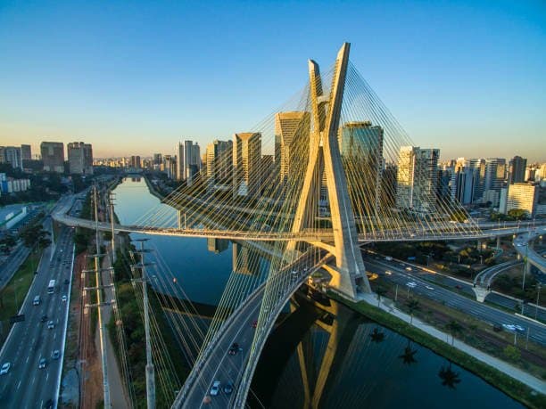
Current forecasts from Brazil’s INMET and global models indicate a typical late-winter pattern over São Paulo, with a subtropical high promoting mostly clear skies and modest daytime heating that favors a maximum near 21–23°C. Weak cold-air advection from the south and limited moisture keep cloud cover low, allowing strong solar insolation to push temperatures toward the middle of the historical August range of 22–24°C, while any increase in southeasterly flow or thin cirrus could cap the peak closer to 21°C. Model spreads remain narrow this close to the event, leaving the tightly bunched market probabilities reflecting uncertainty mainly in boundary-layer mixing and exact timing of any weak frontal approach rather than major synoptic shifts.
Experimental AI-generated summary referencing Polymarket data. This is not trading advice and plays no role in how this market resolves. · UpdatedHighest temperature in Sao Paulo on August 22?
Highest temperature in Sao Paulo on August 22?
22°C 35%
21°C 30%
23°C 28%
24°C 10%
18°C or below
1%
19°C
4%
20°C
5%
21°C
30%
22°C
35%
23°C
28%
24°C
10%
25°C
7%
26°C
1%
27°C
1%
28°C or higher
1%
22°C 35%
21°C 30%
23°C 28%
24°C 10%
18°C or below
1%
19°C
4%
20°C
5%
21°C
30%
22°C
35%
23°C
28%
24°C
10%
25°C
7%
26°C
1%
27°C
1%
28°C or higher
1%
This market will resolve to the temperature range that contains the highest temperature recorded at the Sao Paulo-Guarulhos International Airport Station in degrees Celsius on 22 Aug '26.
The resolution source for this market will be information from Wunderground, specifically the highest temperature recorded for all times on this day for the Sao Paulo-Guarulhos International Airport Station, available here: https://www.wunderground.com/history/daily/br/guarulhos/SBGR.
To toggle between Fahrenheit and Celsius, click the gear icon next to the search bar and switch the Temperature setting between °F and °C.
This market can not resolve until the first data point for the following date has been published on the resolution source.
The resolution source for this market measures temperatures to whole degrees Celsius (eg, 9°C). Thus, this is the level of precision that will be used when resolving the market.
Revisions to temperatures recorded within this market's timeframe will be considered until the first datapoint for the following date has been published, after which any alterations will not be considered.
Market Opened: Aug 20, 2026, 8:55 PM ET
Resolution Source
https://www.wunderground.com/history/daily/br/guarulhos/SBGRResolver
0x69c47De9D...This market will resolve to the temperature range that contains the highest temperature recorded at the Sao Paulo-Guarulhos International Airport Station in degrees Celsius on 22 Aug '26.
The resolution source for this market will be information from Wunderground, specifically the highest temperature recorded for all times on this day for the Sao Paulo-Guarulhos International Airport Station, available here: https://www.wunderground.com/history/daily/br/guarulhos/SBGR.
To toggle between Fahrenheit and Celsius, click the gear icon next to the search bar and switch the Temperature setting between °F and °C.
This market can not resolve until the first data point for the following date has been published on the resolution source.
The resolution source for this market measures temperatures to whole degrees Celsius (eg, 9°C). Thus, this is the level of precision that will be used when resolving the market.
Revisions to temperatures recorded within this market's timeframe will be considered until the first datapoint for the following date has been published, after which any alterations will not be considered.
Resolution Source
https://www.wunderground.com/history/daily/br/guarulhos/SBGRResolver
0x69c47De9D...Current forecasts from Brazil’s INMET and global models indicate a typical late-winter pattern over São Paulo, with a subtropical high promoting mostly clear skies and modest daytime heating that favors a maximum near 21–23°C. Weak cold-air advection from the south and limited moisture keep cloud cover low, allowing strong solar insolation to push temperatures toward the middle of the historical August range of 22–24°C, while any increase in southeasterly flow or thin cirrus could cap the peak closer to 21°C. Model spreads remain narrow this close to the event, leaving the tightly bunched market probabilities reflecting uncertainty mainly in boundary-layer mixing and exact timing of any weak frontal approach rather than major synoptic shifts.
Experimental AI-generated summary referencing Polymarket data. This is not trading advice and plays no role in how this market resolves. · Updated
Beware of external links.
Beware of external links.
Frequently Asked Questions